To celebrate the 20th anniversary of 'Google Earth,' a 'function to check past street views' will be added, and since past satellite images are also available, I tried looking at various things such as Yumeshima and highway construction sites
It's been 20 years since the launch of Google's 3D map service 'Google Earth'. To commemorate the 20th anniversary, Google has released
Google Earth
https://earth.google.com/web/
Google Earth turns 20: A look back on major moments
https://blog.google/products/earth/google-earth-20-years-timeline/
In 2004, Google acquired Keyhole, a company developing digital mapping technology, and released Google Earth as a 3D map application in June 2005. Google Earth attracted so much attention that it was downloaded 100 million times within a week of its release, and it continues to be updated to this day.
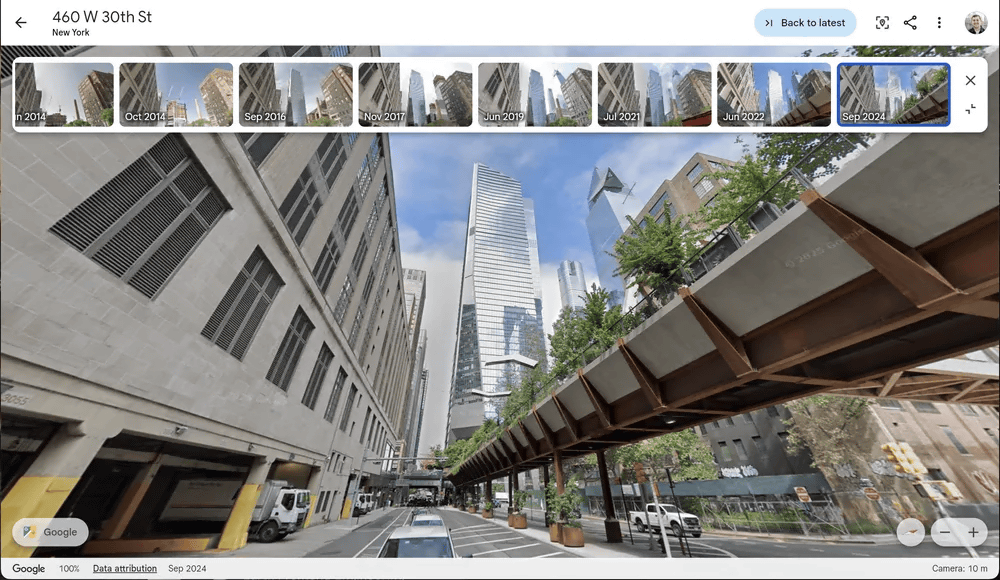
To celebrate the 20th anniversary of Google Earth, Google has announced that it will add a feature that allows users to easily check past Street Views. Below is an example of how it can be used, as published by Google. Images showing past scenes are lined up at the top of the Street View screen, and by clicking on each image, users can check past Street Views.
At the time of writing, the function to check past Street View has not been implemented, but the 'function to check past satellite images'
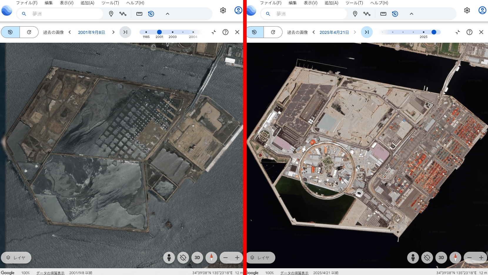
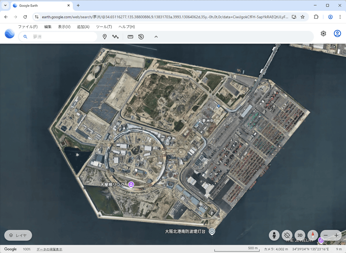
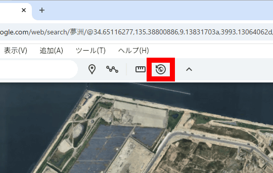
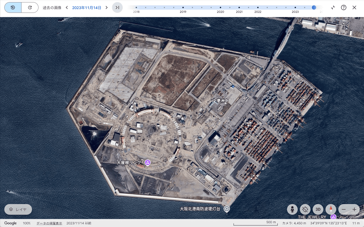
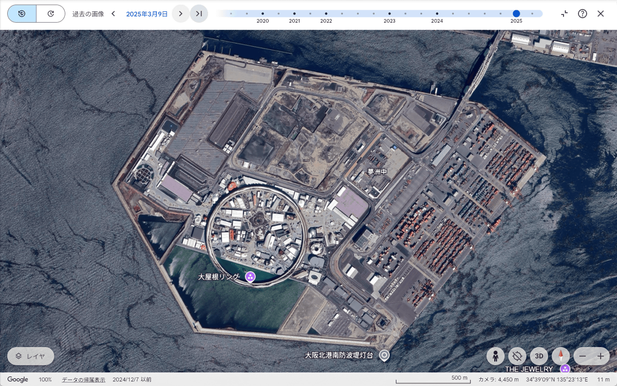
First, access Google Earth in your browser and display the area you want to view past satellite images of. In this example, we displayed Yumeshima, the site of the Osaka-Kansai Expo .
Next, click the button in the red frame at the top left of the screen.
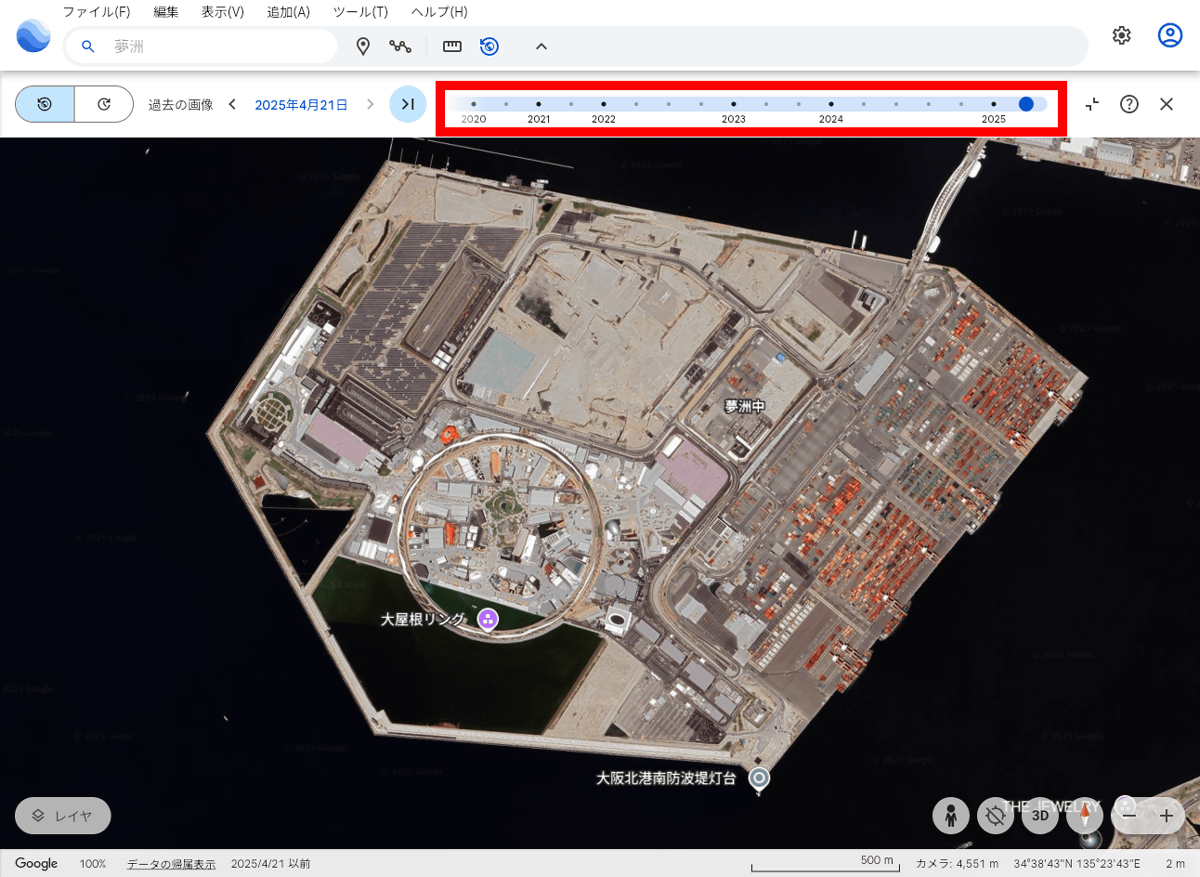
A slider will then appear at the top of the screen. By moving this slider left and right, you can view past satellite images.
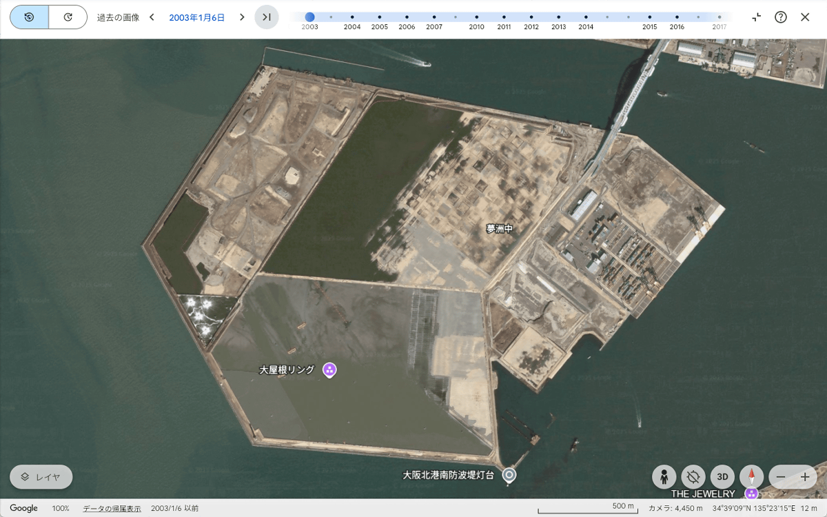
This is what Yumeshima looked like on January 6, 2003. The reclamation work is still in progress, and a large area is submerged.
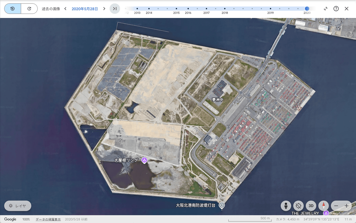
Yumeshima on May 28, 2020. The submerged area has shrunk considerably.
The shape of the Great Roof Ring is beginning to become visible in satellite images taken on November 14, 2023.
On March 9, 2025, just before the opening, the shapes of not only the Great Roof Ring but also the various facilities will become clearly visible.
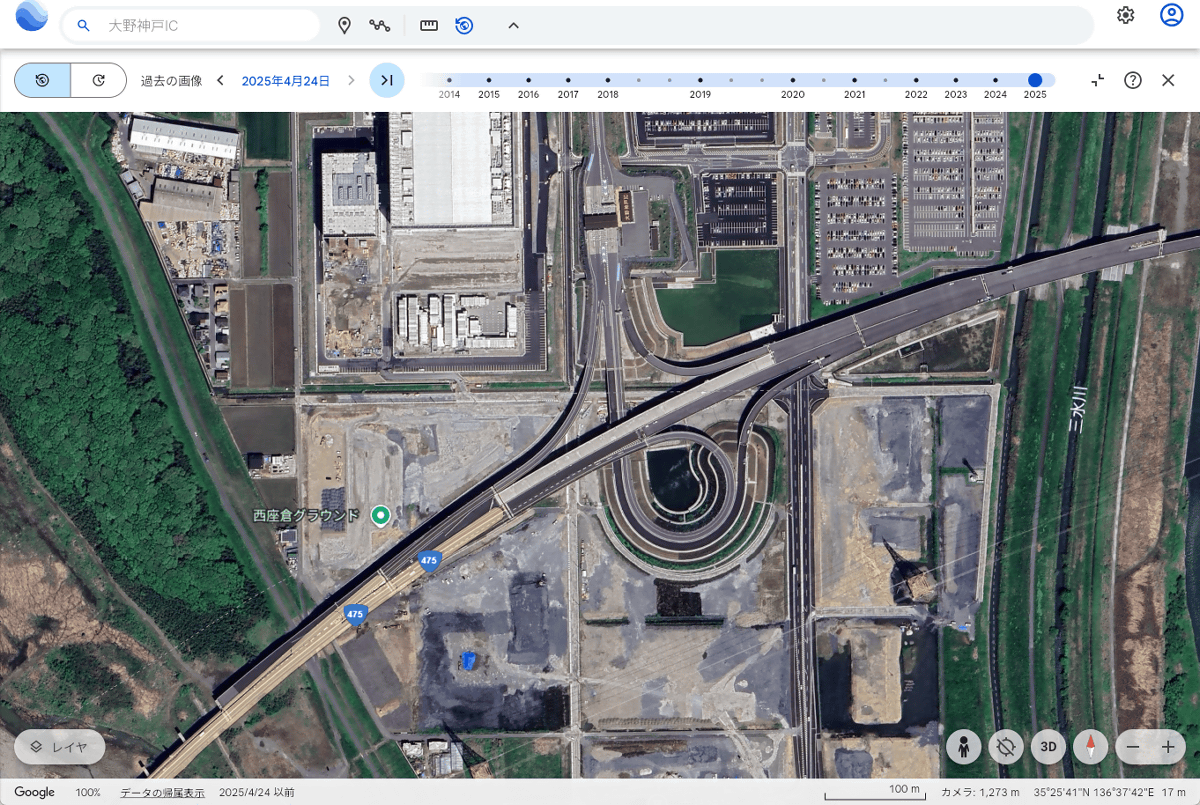
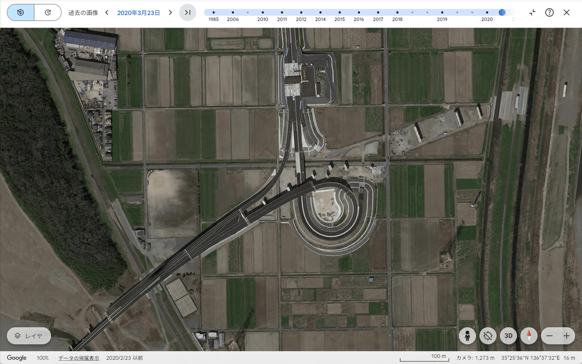
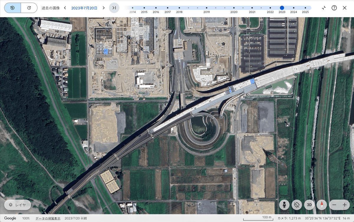
Next, we see the Ohno-Kobe Interchange on the Tokaido Loop Expressway. This interchange opened in December 2019, and construction work is currently underway in the surrounding area in preparation for the full opening of the Tokaido Loop Expressway.
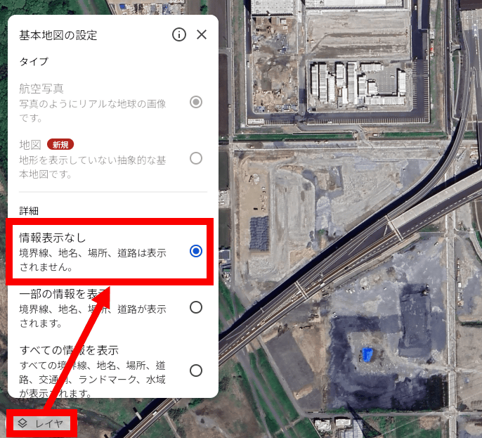
In the standard state, the yellow lines indicating that this is a highway can be distracting, so click 'Layer' at the bottom left of the screen and then click 'No Information Display' to hide the yellow lines.
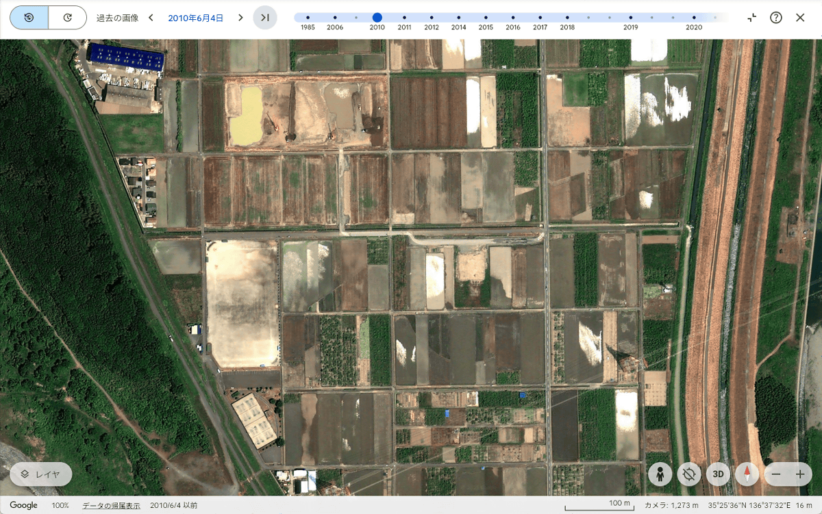
As of June 4, 2010, the area around Ono-Kobe Interchange was still farmland.
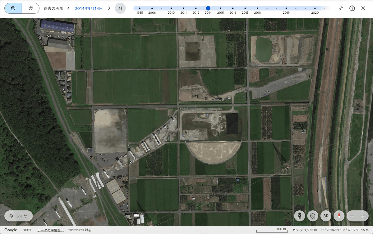
Here's a picture from September 14, 2014. Construction is starting to progress.
On March 7, 2019, the road up to Ono-Kobe Interchange was largely completed.
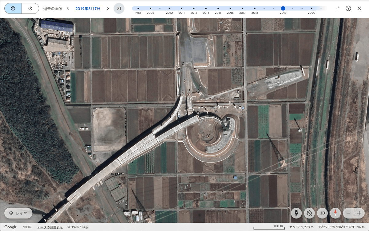
Image taken on March 23, 2020 after the service began. The road to the east of the Ono-Kobe Interchange has not yet been completed.
The image taken on July 20, 2023 shows that construction of the roads on the east side and facilities around the interchange is well underway.
Google Earth allows you to view past satellite images to see how land has changed. In the future, it will be possible to view past street views, as well as tree canopy coverage and ground temperature.
in Review, Web Service, Web Application, Posted by log1o_hf