``J-SHIS Map'' allows you to see at a glance how many S-rank active faults, etc. that are most likely to cause an earthquake in the future, are near your address.
In Japan
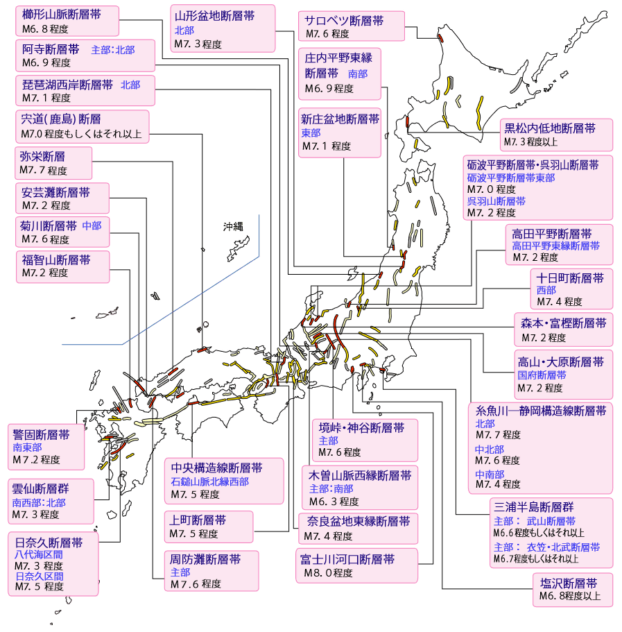
As of January 1, 2024, there are 31 active faults ranked S, which has the highest probability of an earthquake occurring within 30 years, meaning that the probability of an earthquake occurring within 30 years is 3% or more. The list of S-rank active faults that are rated as having the 'highest risk' in the evaluation list of major active fault zones published by the Earthquake Research Promotion Headquarters as of January 1, 2024 is as follows: is.
・Itoigawa-Shizuoka tectonic line fault zone (northern central section)
・Itoigawa-Shizuoka tectonic line fault zone (northern section)
・Itoigawa-Shizuoka tectonic line fault zone (central-southern section)
・Hinagu fault zone (Yatsushiroumi section)
・Sakai Pass/Kamiya fault zone (main part)
・Median Tectonic Line Fault Zone (western section of northern edge of Ishizuchi Mountains)
・Atera fault zone (main part/northern part)
・Miura Peninsula fault group (main part/Takeyama fault zone)
・Miura Peninsula fault group (main part/Kinugasa/Hokubu fault zone)
・Akinada Fault Zone
・Morimoto-Togashi Fault Zone
・Yamagata Basin Fault Zone (Northern part)
・Takada Plain Fault Zone (Takada Plain East Edge Fault Zone)
・Shinji (Kashima) fault case 2
・Kego fault zone (southeast)
・Tonami Plain Fault Zone/Kurehayama Fault Zone (eastern part of the Tonami Plain Fault Zone)
・Tonami Plain Fault Zone ・Kurehayama Fault Zone (Kurehayama Fault Zone)
・Yasaka Fault
・Hinagu fault zone (Hinagu section)
・Shonai Plain eastern edge fault zone (southern part)
・Shinjo basin fault zone (eastern part)
・Kuromatsunai Lowland Fault Zone
・Kushigata Mountains Fault Zone
・Nara basin eastern edge fault zone
・Takayama-Ohara Fault Zone (Kokufu Fault Zone)
・Sarobetsu Fault Zone
・Shiozawa Fault Zone
・Suonada fault zone (Suonada fault zone main section)
・Kikugawa fault zone (Chubu section)
・Unzen fault group (southwest/northern)
・Kiso Mountains western edge fault zone (main part/southern part)
・Tokamachi fault zone (western part)
・Kamimachi Fault Zone
・Lake Biwa west coast fault zone (northern part)
・Fukuchiyama Fault Zone
' J-SHIS Map ', which allows you to easily check information such as whether these active faults are near your area and what kind of active faults they are, has been released by
J-SHIS Map
https://www.j-shis.bosai.go.jp/map/
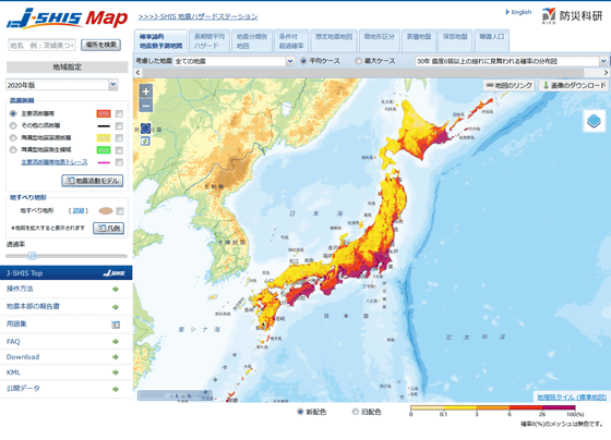
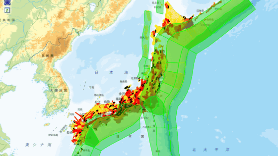
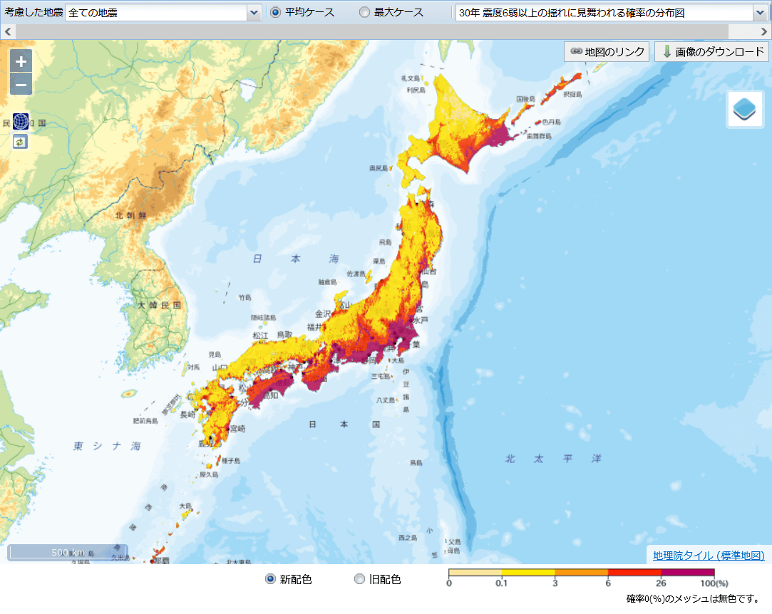
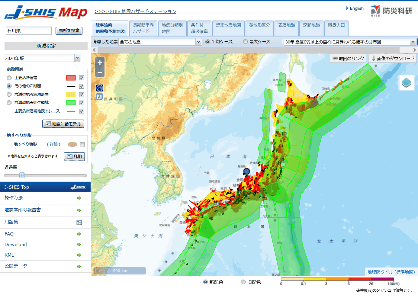
In its initial state, the map is a ``distribution map of the probability of being hit by an earthquake with an intensity of 6 or higher within 30 years,'' and the closer the color on the map is to yellow, the lower the probability that a tremor with an intensity of 6 or higher will occur. %, and the closer to purple it is, the closer to 100% the probability that an earthquake with an intensity of 6 or lower will occur.
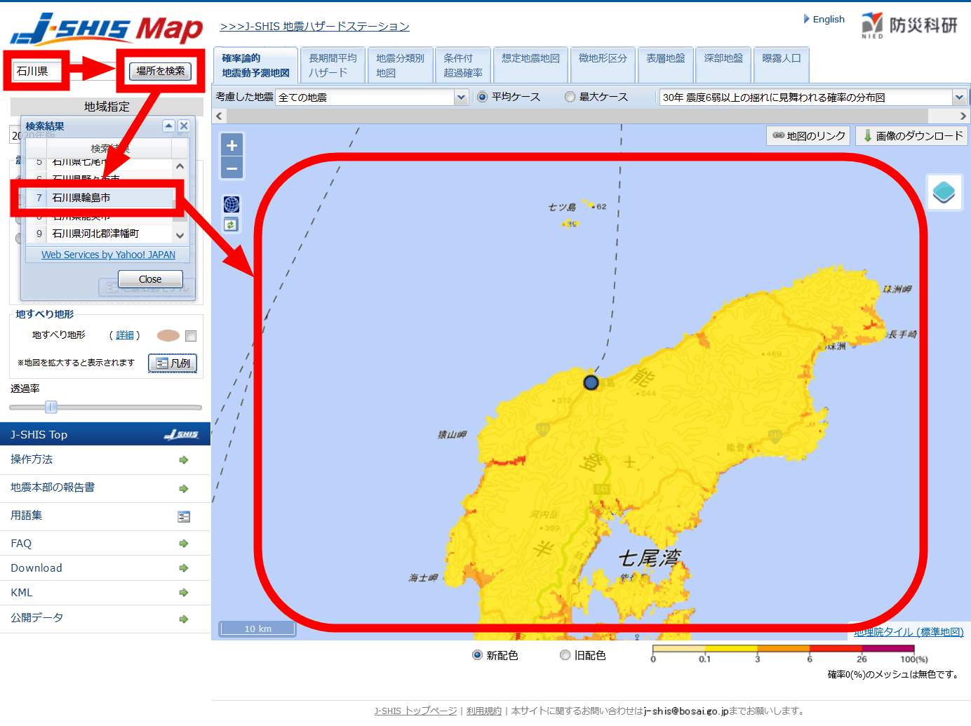
You can search for a specific point using the search box at the top left of the map. When I tried entering 'Ishikawa Prefecture' and clicking 'Search location', multiple candidate locations were displayed as search results. Suzu City, the epicenter of the main shock of
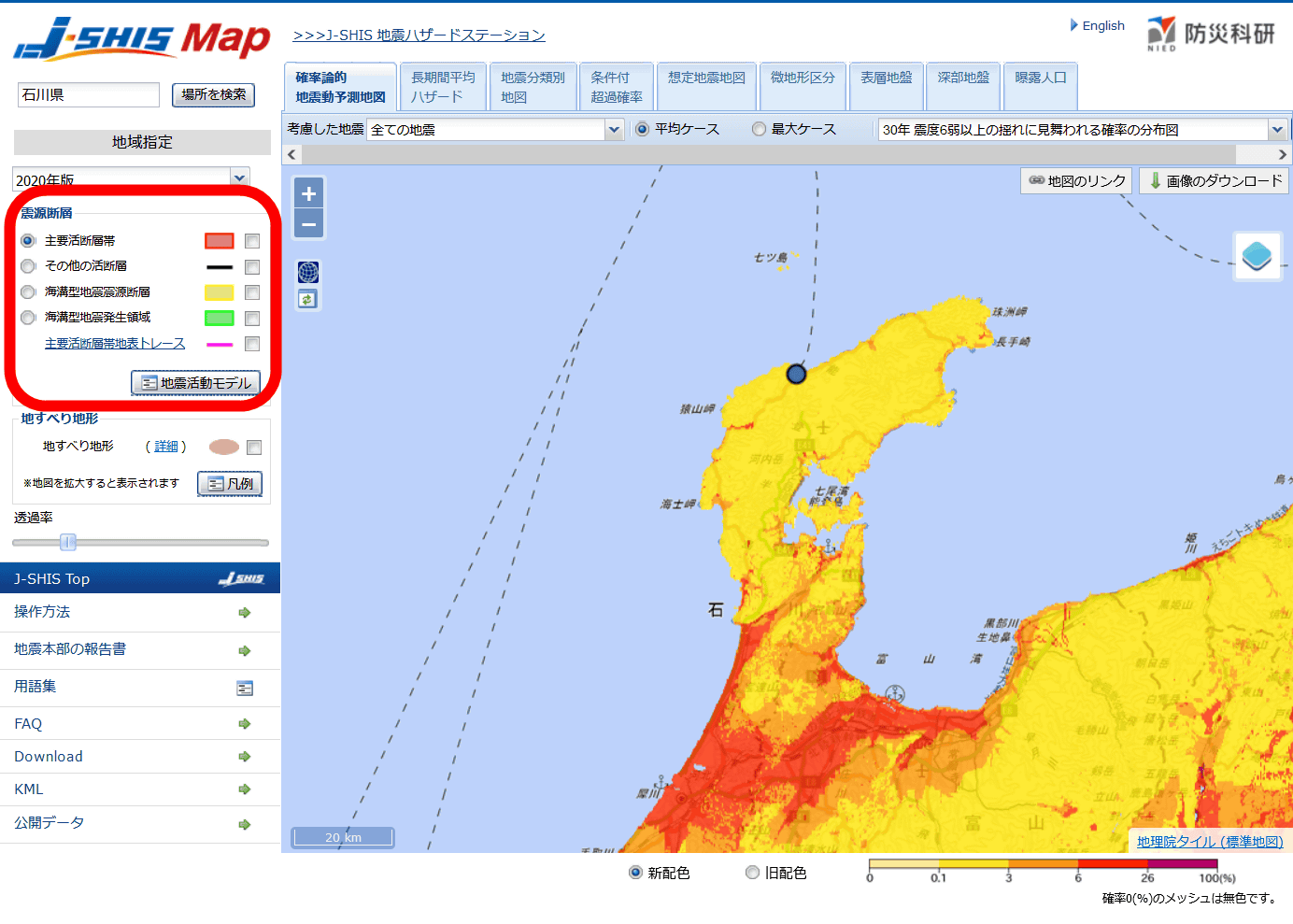
Below the search box that allows you to specify the region, there is 'Earthquake Source Fault', 'Major Active Fault Zone' (red), 'Other Active Faults' (black), 'Subduction Trench Earthquake Source Fault' (yellow), and 'Subduction Trench Earthquake Source Fault' You can check the following items: 'Earthquake occurrence area' (green) and 'Major active fault zone surface trace' (pink).
If you check 'Major active fault zone', it will be as follows. The locations of major active fault zones are shown on the map as translucent red shapes.
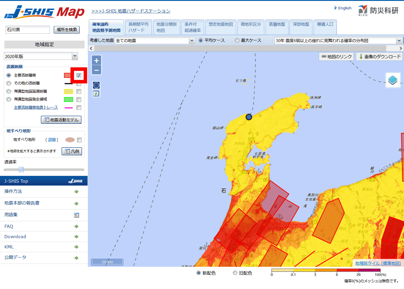
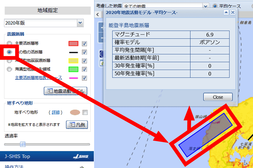
Clicking on a major active fault zone will display the assumed magnitude, adopted probability model, average interval of occurrence, period of latest activity, 30-year probability of occurrence, 50-year probability of occurrence, etc.

If you check 'Other active faults', it will be as follows. In the case of Wajima City, it can be seen that other active faults exist closer to the main active fault zone.

To display detailed information on seismic source faults other than major active fault zones, click the check mark to the left of the 'seismic source fault' you want to display, then click on the seismic source fault for which you want to display information. Since there were no major active fault zones near Wajima City, we displayed detailed information on other active faults. Other active faults seem to have less information displayed than the main active fault zones.
I also displayed the ``subduction zone earthquake source fault'' and ``subduction zone earthquake occurrence area.'' The 'subduction zone earthquake source fault' completely overlaps the 'subduction zone earthquake occurrence area,' so if you display the two at the same time, it will appear that the 'subduction zone earthquake source fault' is not displayed. If you erase 'Earthquake occurrence area', you can check 'Subduction trench earthquake source fault'.
in Review, Web Service, Posted by logu_ii